
Advanced Drone Services
Pennsylvania – New Jersey – New York – Delaware – Maryland
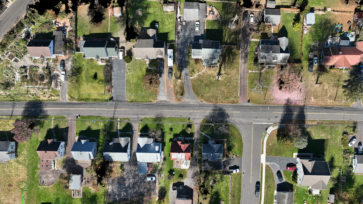
Orthomosaic Maps
2D High Resolution photogrammetrically orthorectified image maps.
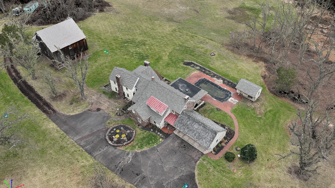
3D Textured Mesh
Virtual environment created from point overlaid with textured mesh.
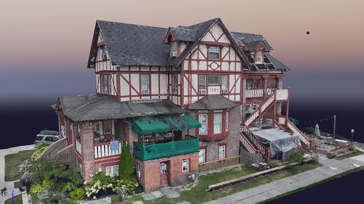
3D Modeling
High Resolution 3D Digital twin.
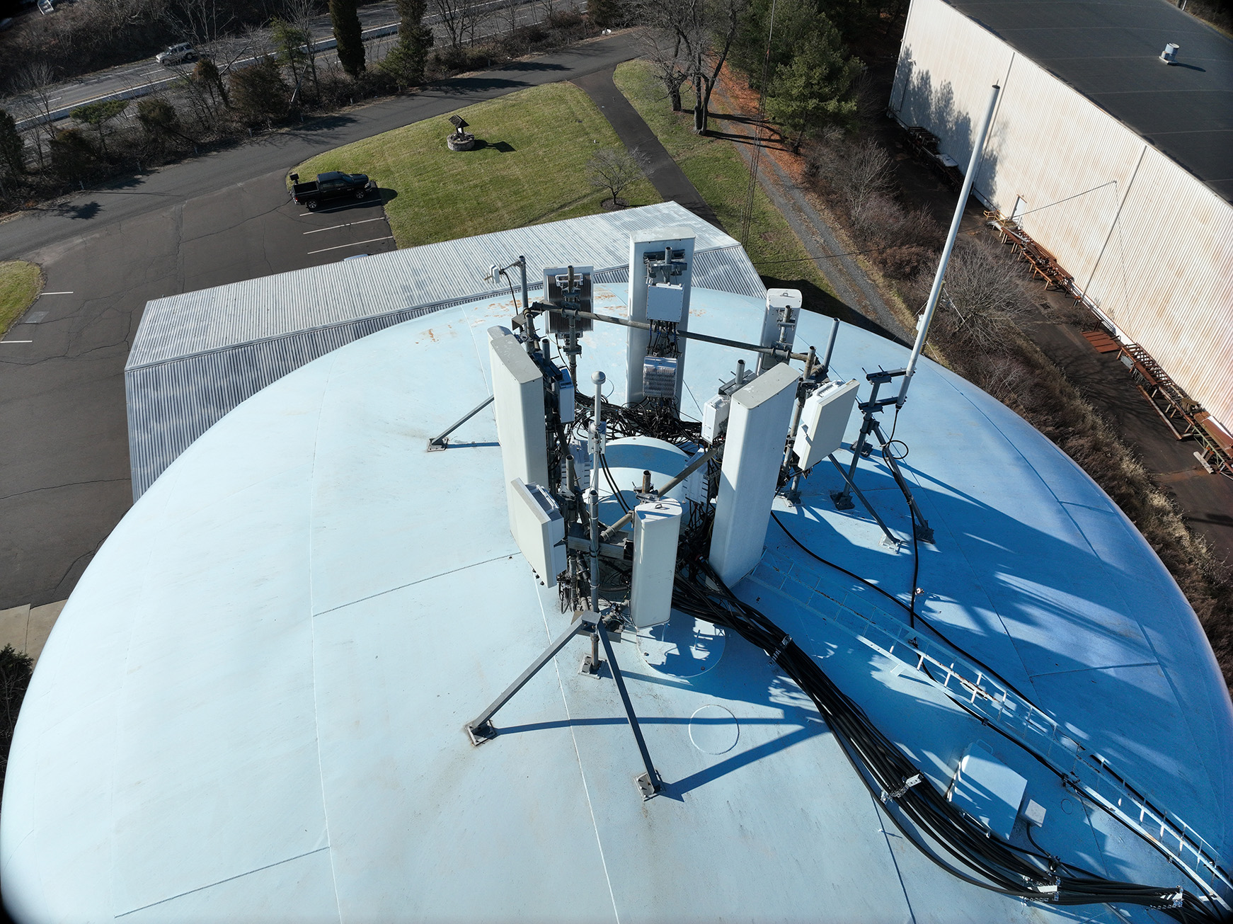
Inspection Services
4k Video and HDR photos provided at several altitudes for visual inspection.
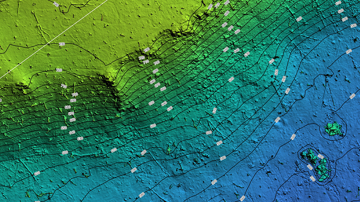
Topographic Maps
2D High Resolution photogrammetrically orthorectified topographic maps.